| Price | $1.29 |
|---|---|
| Category | Tools |
| Version | 2.0 |
| Developer | Corbella |
| Added | Apr 15th, 2012 |
| App Views | |
| Votes | 0 votes |
| Google Rating | |
| Ratings | 5 |
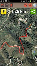
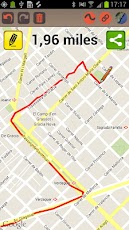
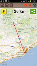
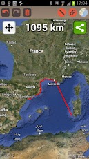
"Map Distance" is a distance calculator that allows you to know the distance of any path/route drawn on the map. JUST DRAG YOUR FINGER ON THE MAP and see in real time the overall distance! Very useful to plan your runs, bike rides, hikes, etc. Also is perfect to calculate distances between countries, cities, streets as well as length of trails or routes.Features:- Uses offline Google Maps: Once you have downloaded a region, you don’t need internet connection.- Ability to draw free lines (direct finger move) or straight lines.- Ability to draw connected or separated segments.- Can change map mode between Map/Satellite- Have an UNDO and REDO functionalities.- Can show the distance in international units (meters/Km), American units (feet/miles) or yards/miles.- Can share or send the drawn route by mail in KML format.- The application can be used in portrait/landscape mode.- Shows your current location, allowing to know the distance between you and other places.
App Screenshots
Other Tools Apps