

| Price | $138.00 |
|---|---|
| Category | Travel & Local |
| Version | 1.19 |
| Developer | Rolf Schade |
| Added | Oct 25th, 2011 |
| App Views | |
| Votes | 0 votes |
| Google Rating | |
| Ratings | 11 |
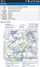
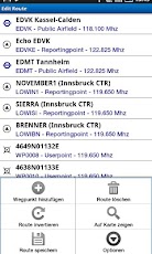
Sky-Map is a Moving Map Navigation System for General Aviation. It has the following functionality: – Moving Map: Displays the actual position on digital aviation charts, like ICAO chart from DFS (Maps not included !) – Fast move and zoom of the map – Flightplanning: Flights can be planned direct on the map or using the waypoint database. – Routes can be saved, loaded or modified – Calculation of distances, flighttimes, wind influence, fuelconsumption – Automatic display of approach/airport charts (if AIP is installed) – Airspace warnings – "Direct to" function – "Nearest Airports" function – AIP Browser: displays of approach/airport charts as well as text information (if AIP is installed) – PCMet Browser: Quick access to weather information (additional costs for pc_met access apply) – Logbook function: automatic logging of Starttime/Position, Landingtime/Position und Flighttime – Infopanels (configurable) for Speed, Altitude, Distance, Time aso.. The software contains an worldwide basemap (not for navigation), additional charts from the Flight Planner/Sky-Map selection have to be installed. For purchasing of maps see http://www.sky-map.de/order.php
App Screenshots

Other Travel & Local Apps


