

| Price | Free |
|---|---|
| Category | Travel & Local |
| Version | 2.0 |
| Developer | ?????????GIS?????? |
| Added | Mar 28th, 2013 |
| App Views | |
| Votes | 0 votes |
| Google Rating | |
| Ratings | 20 |
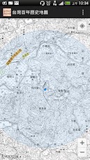
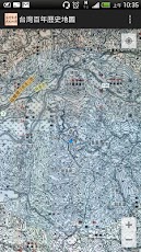
The project of ‘Map and Remote Sensing Imagery Digital Archive’, implemented by the GIS Center of the RCHSS, Academia Sinica, has resulted in the compilation and digitization of maps of Taiwan from various periods. The results have now been used to develope an application through GIS that allows the overlaying of maps of different times to explore the topography and original conditions of all sorts of places around Taiwan and their humanities settlement and land usage. It is a great tool for grasping hold of home geography and land/environmental transitions, well suited for use during fieldwork or travels.
App Screenshots


Other Travel & Local Apps


