| Price | Free |
|---|---|
| Category | Transportation |
| Version | f1.1.2 |
| Developer | nemode |
| Added | Sep 5th, 2010 |
| App Views | |
| Votes | 0 votes |
| Google Rating | |
| Ratings | 73 |
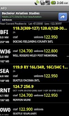
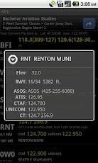
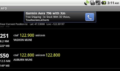
This application is intended to provide quick reference to the pilot for nearby airports while in the air. While in the air it’s assumed you don’t have radio on (except GPS) so access to other internet-based information isn’t available. This is a self-contained application that has all airports in the US. Currently excludes private airports to save size. GPS accuracy is NOT dependable (device dependent and not certified) so be a prepared pilot and use this as a supplemental information source while in the air.Location aware, provides FAA airports within 30 miles of your position. Great for having Control tower, CTAF, Unicom handy while you’re flying. Updates as you fly, in a battery friendly way. Currently updates every 2 mins or 10 miles. GPS accuracy is NOT dependable so be a prepared pilot and use this as a supplemental information source while in the air.Not meant to do your flight prep – meant for in-flight assistance! Small and nimble, requires no fumbling while flying – just tap on an airport for more details.Use it? Rate it! Really! Helps us determine if and how to evolve the application!
App Screenshots
Other Transportation Apps