
| Price | Free |
|---|---|
| Category | Transportation |
| Version | 1.7.1 |
| Developer | 123west Software Inc. |
| Added | Apr 19th, 2011 |
| App Views | |
| Votes | 0 votes |
| Google Rating | |
| Ratings | 202 |
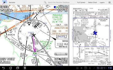
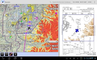
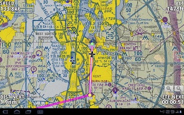
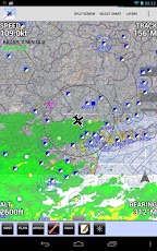
Naviator is a moving map GPS application made by pilots, for pilots.!!!!!!!!!!!!!!!! IMPORTANT !!!!!!!!!!!!!!!!This is a 30 day FREE TRIAL of Naviator. Please see the "Subscription Information" section below for more details.!!!!!!!!!!!!!!!! IMPORTANT !!!!!!!!!!!!!!!!FEATURES:* Moving map with airspace, airports, radio navigation aids, airway intersections, TFRs* Support for Bluetooth ADS-B receivers including the Dual XGPS 170* Track-up map display* All navigational data is downloaded to your device – no internet connection is required while you are flying* Global terrain database with terrain warnings* Global high-detail VFR base map* World-wide airports/facilities database containing over 53,000 airports and navaids (updated on a 56 day cycle)* Easy "rubber band" flight planning* Global Forecast Engine provides winds aloft anywhere on the planet up to 54,000 feet* Integrates with the Zaon XRX for traffic display* DUATS integration – get a briefing and file a flight plan from right inside the app* Weather information (METAR/TAF/NEXRAD/SIGMET/AIRMET)* Victor Airways and Jet Routes* FAA VFR sectional charts* FAA VFR terminal area charts* FAA IFR enroute charts* FAA approach plates and airport diagrams (optionally geo-referenced)* User defined waypoints* Vertical navigation (VNAV) calculator* TFR areas are displayed on the map. Tap within a TFR area to see affected altitudes and other details* Canadian data including airspace, airports, navaids, terrain and weather* GPS track recording – export to GPX file format* View your recorded flights in 3D with Google Earth* NMEA output – Naviator can drive your aircraft’s autopilot* "Bring Your Own Charts" – you can import custom maps and charts into the app. See our forum for more details.Our support forum is located at http://forum.naviatorapp.com/SUBSCRIPTION INFORMATION:Subscriptions provide access to all software updates, FAA Sectional charts, FAA Terminal Area charts, FAA IFR Enroute charts, FAA approach plates, weather updates, TFR updates, and the Naviator world-wide airports and facilities database.PRICING:Naviator is free of charge for the first 30 days of use. After this trial period, the following items may be purchased:(a) 30 Day Chart Subscription – $4.99 USDEnables the download and use of geo-referenced charts for 30 days.(b) 1 Year Chart Subscription – $34.99 USD*** 30% OFF SALE – REG. PRICE $49.99 *** Enables the download and use of geo-referenced charts for one year. *The purchase of a one year subscription includes item (c) in the purchase price.(c) Unlock Naviator – $14.99 USDThis one-time charge permanently unlocks all features of Naviator, except FAA approach plates, sectionals, TACs, IFR enroute charts, TFR updates and the "BYOC" feature.Includes database updates, weather updates, high-detail VFR base mapItems (a) and (b) include VFR sectional charts, terminal area charts, IFR enroute HI/LO charts, approach plates, database updates, weather updates, TFR updates, and the high-detail VFR base map.
App Screenshots
Other Transportation Apps