
| Price | Free |
|---|---|
| Category | Transportation |
| Version | 2.0 |
| Developer | ??Droid |
| Added | Sep 20th, 2011 |
| App Views | |
| Votes | 0 votes |
| Google Rating | |
| Ratings | 3 |
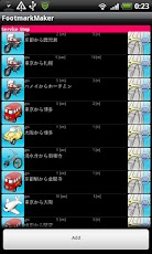
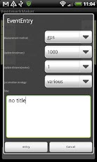
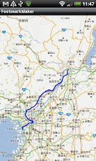
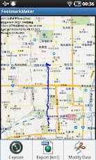
– OutlineIt is an application that does the GPS data in the tracking. The acquired GPS data can be superimposed to GoogleMap. Moreover, the superimposed data can be preserved as an image. ?- Registration of EventThe Add button is pressed before the GPS data is acquired. The method of acquiring the Event name and the GPS data and the update timing of GPS (distance at time) are selected. – Beginning of recordWhen the registered Event name is selected, the dialog is displayed. The acquisition of the GPS data begins when "start" is selected. When the GPS data is begun, "Running…" is displayed. When the data collection has already been begun, the data collection is not made. – End of recordWhen the registered Event name is selected, the dialog is displayed. When "stop" is selected, the acquisition of the GPS data is stopped. When the data collection is stopped, "Stop…" is displayed. – Correction of EventWhen the registered Event name is selected, the dialog is displayed. When you select "modify"The method of acquiring registered Event name and GPS data and the update timing of GPS (distance at time) can be corrected. – Deletion of EventWhen the registered Event name is selected, the dialog is displayed. Event can be deleted by selecting "delete". – Map buttonThe acquired data is drawn when the Map button is pressed and the line can be drawn on GoogleMap. – Capture functionThe GPS data displayed in GoogleMap can be preserved as an image. Preserving ahead /sdcard/footmarkmaker/Capture _ date. It is preserved as jpg. – Method of acquiring GPSIt is possible to select it according to three kinds of the following. GPS(GPS,AGPS) WIFI(AGPS,CellID,Wifi MACID) Criteria- Output directoryData is preserved in the following directories. /sdcard/footmarkmaker/data-Revision history-Ver 1.10 The addition of the menu icon of a map screen.-Ver 1.9 Correction of the map icon of a list screen.-Ver 1.8 Correction of a status display of a Map screen.???? The addition of the function which displays time of onset, end time, and lapsed time.-Ver 1.7 It is the addition of the repair capability of data in a Map screen. ???? The function in which a starting position and an end position are correctable is added.- Ver 1.5 & 1.6 Correction of the screen in application- Ver 1.4 It corrects so that a record state may be known by a color in a list screen.?????Background of the character representation portion for status Red Under a record stop. Background of the character representation portion for status Green Under record.-Ver 1.3 Translation-into-Japanese correspondence of a registration screen-Ver 1.2 Export KML-Ver 1.1 Display of measurement distance of acquired GPS data.-Ver 1.0 Icon change of FootmarkMaker-Ver 0.5 & 0.6 Bug fix when screen changes-Ver 0.4 It is corrected that all the acquired data is superimposed to GoogleMap. -Ver 0.2 & 0.3 Correction of part where data when changing to screen of GoogleMap is passed. The number of data superimposed to GoogleMap is limited to about 1500 points. -Ver 0.1 Bug fix
App Screenshots
Other Transportation Apps